Lambert St. Louis International Airport (STL)
Driving Directions / Travel by Car
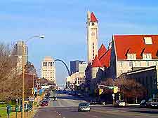
(St Louis, Missouri - MO, USA)
Standing on the northwestern side of St Louis, close to Berkeley, Bridgeton, Hazelwood and Florissant, the Lambert St Louis International Airport (STL) is surrounded by fast interstates and highways, making access from all directions easy. On the southern side of Lambert Airport, the I-70 interstate skirts the edge and provide fast access to the city of St Louis, passing many points of interest along the way, such as Cool Valley, Norwood, Penrose Park, Bellefontaine Cemetery and Ofallon Park.
On the northern side of St Louis Airport you will find Lindbergh Boulevard and the James S. McDonnell Boulevard, while the Natural Bridge Road is located to the south. The Airport Road provides access to the grounds from the east, off the I-70 interstate and North Hanley Road.
Within the airport complex itself, the Banshee Road runs parallel to the railway line along the northern outskirts.
Prominent landmarks close to St. Louis include the Boeing Integration Center to the west, the Ford Motor Assembly Plant to the north, the Maryland Heights to the southwest, and both Edmundson and the Breckenridge Hills to the south.
Directions to St Louis International Airport (STL) from the city center:
- Travel along the main interstate I-70 (Express Lane) in a northerly direction
- Exit at junction 236 and follow the signs to St Louis Airport
Lambert St. Louis International Airport (STL): Virtual Google Maps
